September 19, 2026 Post by : Editorial Glacial Landforms
Roche Moutonnées: The Asymmetrical Hills That Point the Way Ice Moved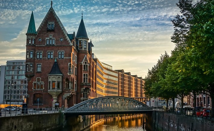
Stand in a quiet, dry valley in the middle of a farming landscape and you might notice something odd: the valley is far too large for the trickle of water, or the complete absence of water, at its bottom. These oversized, winding troughs are meltwater channels, and they are among the most underappreciated clues that an ice sheet once sat on the landscape. Unlike river valleys, which grow gradually through persistent erosion, meltwater channels were often cut with startling speed by enormous volumes of water released from melting ice.
Meltwater channels form wherever water drains from a glacier or ice sheet. Some were carved by streams flowing along the ice surface, others by water tunnelling beneath the ice under pressure, and still others by water escaping along the ice margin. Each setting leaves a slightly different signature. Channels cut beneath the ice tend to run uphill in places, because the water was confined by ice pressure and did not have to obey gravity in the way a normal river does. Channels along the ice margin often follow the contour of the land in long, sweeping arcs.
Why the Channels Are Dry Today
The most striking thing about many meltwater channels is that they are abandoned. Once the ice retreated and the meltwater source disappeared, the channel was left high and dry, sometimes perched on a hillside far above any modern stream. This is why geographers often call them 'dry valleys' or 'overflow channels.' In some cases, a small stream later adopted part of the channel and now flows through a valley that is comically large for its discharge.
The scale of these features tells us about the volume and speed of meltwater. A channel tens of metres deep and hundreds of metres wide cannot be explained by ordinary rainfall runoff. It requires sustained, high-energy flow, the kind produced when a large ice mass is melting rapidly or when a subglacial lake suddenly drains. Some channels are cut into solid bedrock, while others are eroded into loose glacial sediment, and the difference affects how sharply defined their edges remain after thousands of years.
Reading Meltwater Channels in the Field
For anyone learning to read glacial landscapes, meltwater channels are a rewarding feature to study because they are common, visible, and varied. Look for valleys that seem out of proportion to their present drainage, especially where they cut across slopes rather than following the regional downhill direction. Anastomosing patterns, where a channel splits and rejoins around islands of higher ground, are a strong hint of meltwater origin, since sediment and ice blocks could divert the flow repeatedly.
Meltwater channels also matter beyond pure geomorphology. They influence modern drainage, soil distribution, and even where roads and settlements were built, because their flat or gently sloping floors often provide useful routes through hilly terrain. Farmers value the well-drained floors of some channels, while others remain boggy where peat has accumulated. Together with drumlins, eskers, and moraines, meltwater channels complete the picture of a landscape shaped by ice and water working together. Next time you walk a dry valley, imagine it roaring with glacial meltwater, and the quiet ground beneath your feet becomes far more dramatic.
Author
22 feb,2025
This incident opened my eyes to the value of Insurance in general, so I decided to examine my personal and business insurance.
Comment (3)
The payments are made directly from one person to another without passing through a central bank or clearing house.
22 feb,2025
ReplyVarves: Counting Ancient Summers in Layered Lake Sediments
23 feb,2025
ReplyDrumlins 101: How Ice Sheets Sculpted the Rolling Hills of the North
23 feb,2025
Reply